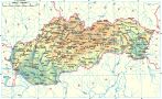
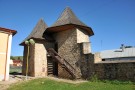
Little town Podolínec is situated in the valley of the river Poprad, on the boundary of the mountains Spišská Magura, Podtatranská basin and Levočské mountains. The first written reference about Podolínec is from the year 1235. In 1412, Hungarian king Žigmund awarded this town a privilege to be a royal free town and shortly after it was given to the Polish king as a deposit for a credit. The town was surrounded by city-walls and a gothic castle existed in the urban area.
Later, in 1772 after reunification of Austria-Hungary, Podolínec started to decline and became a rural village.
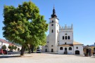
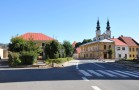
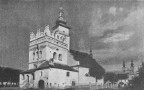
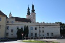
You can find there a Roman-Catholic Church of the Virgin Mary from 1298 with a gothic and baroque interior and precious wall paintings coming from 1360 - 1430, a bell-tower in the Renaissance style, a chapel of St. Anna from the 13th century and a Piarist monastery from the year 1632.